
Mastering Map Reading
- Kate Lyon
- Oct 28, 2025
- 2 min read

Updated: Nov 12, 2025
Understanding Contour Lines
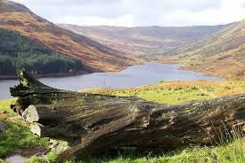
Whether you’re an avid hiker, an outdoor enthusiast, or just curious about topography, reading maps is an essential skill. Among all the features on a topographic map, contour lines are the key to unlocking the landscape’s three-dimensional secrets. This blog will guide you through understanding contour lines and using them effectively.
What Are Contour Lines?
Contour lines are curved lines on a map that connect points of equal elevation. Essentially, they tell you how high or low the terrain is at different points and reveal the shape of the land—hills, valleys, ridges, and depressions.
Close lines indicate steep terrain.
Widely spaced lines indicate gentle slopes.
Circular lines often represent hills or depressions.
Each line has a contour interval, the vertical distance between lines, which is usually listed in the map legend. For example, a 10-meter contour interval means each line represents a 10-meter elevation change.
How to Read Contour Lines
Identify the elevation: Look at the labelled contour lines. These numbers tell you the height above sea level.
Observe the spacing: Steep areas have tightly packed lines; gentle slopes have lines that are far apart.
Recognize shapes:
- V-shaped lines pointing uphill indicate valleys.
- V-shaped lines pointing downhill indicate ridges.
- Closed loops usually indicate hills; if marked with hachures (short lines inside the loop), it’s a depression.
- Estimate elevation changes: Count the number of lines between points and multiply by the contour interval to estimate the vertical difference.
Practical Tips for Navigating with Contour Lines
Plan your route wisely: Steep ascents or descents can be tiring; contour lines help you identify gentler paths.
Understand water flow: Streams often run through valleys. The contour lines form a “V” that points upstream.
Avoid surprises: A flat-looking area might suddenly turn steep if the lines tighten; always check the map before heading out.
Why Map Reading Still Matters
Even with GPS technology, maps and contour lines remain invaluable. They don’t rely on battery power, can give a better sense of the surrounding terrain, and are essential in emergency navigation.
Conclusion
Contour lines are the secret code of the landscape. Once you learn to read them, you gain a deeper understanding of the terrain, making your outdoor adventures safer and more enjoyable. So grab a topographic map, find the contour lines, and start exploring the world in 3D!
If you want, I can also create a visual guide with diagrams of contour lines that would make this blog even more beginner-friendly and interactive.


Comments